
New York City scenic running routes in Brooklyn and Manhattan motivate and inspire as you train for that upcoming marathon, half-marathon, 10-K or 5-K.
Adding new running routes or paths to a training routine can help reset your mind and motivation in the middle of a tough training season. Of course, it also helps if the scenery is impressive. The New York City area running routes listed below provide sweeping, picturesque views of the city, rivers, and lakes.
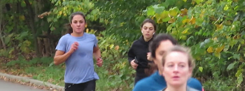
Running Route: Prospect Park Loop in Brooklyn
An official map with mileage for the loop can be found on the Prospect Park running page.
The main loop around Prospect Park follows Park Drive and measures 3.35 miles. Running counter-clockwise from the Grand Army Plaza/ Brooklyn Public Library entrance, the path begins at Long Meadow lawn (lively with picnics on weekends) and travels past baseball fields.
At approximately 1.4 miles into the run, the path begins to provide refreshing glimpses of Prospect Park Lake. Another mile later, the path cuts through various concert groves, including Drummer’s Grove, which always seems to be rocking out on weekends with African drums and hippie dancers, briefly adding a nice background rhythm to the run. The last mile bypasses the edge of the famed Prospect Park Zoo.
In this direction, the run starts out easy and relatively flat for the first three-quarters, and then in the last stretch makes its way up a substantial hill that causes many runners to lose steam.
For a longer run: Twice around (6.7 miles) and three times around (10 miles) the loop are both common runs. Another option is to add mileage to the loops with any of the less-traveled paths through the center of the park. Use map my run to measure the distances of any run. Take note it is surprisingly easy to lose the way in Prospect Park once one stops running in a loop.
Running surface: paved road, with a frequent option to run along a narrow dirt trail that parallels the road.
Nearby public transportation: 2 and 3 trains (Grand Army Plaza station); F train (15th St station); B, Q, and S trains (Prospect Park station)
Running Route: Cadman Plaza Track and the Promenade in Brooklyn Heights
Even Brooklyn Heights locals may walk past Cadman Plaza daily and not realize there is a hidden track-like path under the cover of the London plane trees that encircle the plaza lawn. This loop measures approximately 0.4 miles, perfect for short runs, runs where precision is desired, or low-impact runs on a soft surface. Someone has marked off distances for precision running. As an added bonus for summer evening runs, the path is dotted with fireflies.
Pairing a few loops around the plaza with runs up and down the nearby 0.3-mile Promenade (the Brooklyn Heights esplanade, from which downtown Manhattan, the Statue of Liberty, and Brooklyn Bridge can all be ogled) makes for an inspiring run with breathtaking views. Both the Cadman Plaza and the Promenade paths are fairly flat.
For a longer run: Running endless loops around the relatively small Cadman Plaza, while adding distance, may get tedious. Adding runs along the Brooklyn Bridge (in addition to the aforementioned Promenade) is a common longer run in the area. The length of the Brooklyn Bridge one way is 1.1 miles.
Running surface: the Cadman Plaza track is made of synthetic turf. The Promenade is a paved walkway.
Nearby public transportation: A and C trains (High Street station); 2 and 3 trains (Clark station); M and R trains (Court Street station).
Running Route: Central Park Main Loop in Manhattan
An official map with mileage for the loop can be found on the Central Park running page.
The classic run in the New York City area is the 6.1-mile main loop along the East and West Park Drives around Central Park. Starting from the southwest corner of the park and running counter-clockwise, the run takes one past the iconic Mall, the Metropolitan Museum of Art in the Upper East Side, the eastern edge of Jacqueline Kennedy Onassis Reservoir, and then up through North Woods and the steep incline of what marathon runners lovingly call Heartbreak Hill at the northern end of the park in Harlem. The path then makes its way down the west side of the park, providing views of magnificent Upper West Side buildings.
For a longer run: Adding a few loops around the Reservoir at the center of Central Park is highly recommended. Once around the Reservoir is 1.58 miles. Although the main loop described above does pass along the edge of the Reservoir, the best views of Manhattan are had from the inner track that hugs the actual reservoir water.
Running surface: The main loop along Park Drive is on a paved road (conveniently closed to vehicles on weekends and certain times of day on weekdays). The Reservoir Loop is on a soft cinder track.
Nearby public transportation: Central Park is accessible by a multitude of trains. See the MTA New York City Subway map.
New York runners can use these running routes in various combinations to add visual inspiration to runs of all lengths, rejuvenating a tired routine.