
Covering more than 2 square miles, Bay Ridge is one of the largest neighborhoods in Brooklyn, New York. This district is situated along the Narrows, which is a strait that divides Brooklyn and Staten Island. Bay Ridge is home to an extensive greenway system that leads to waterfront parks, piers, and historic military forts. Click to book your Brooklyn Hop-On Hop-Off Bus Tour.
Attractions and Sightseeing
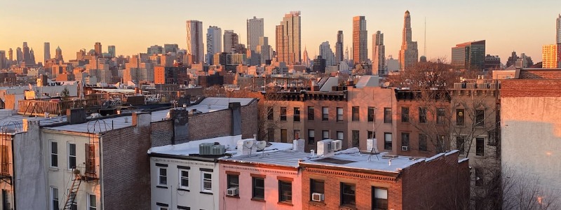
Bay Ridge has an extensive waterfront section that overlooks the Narrows, which is the official name for the body of water that divides the upper and lower portions of New York Bay. As you walk the district’s promenades and trails, you’ll enjoy panoramic views of the neighboring borough of Staten Island. Some binoculars or telescopes could also be handy for viewing the skyline of New Jersey’s largest cities, including Newark and Jersey City. In fact, the waterfront of Bay Ridge offers great views of air traffic at the Newark Liberty International Airport. Additionally, you might spot some enormous freight ships that enter and exit the Port of Newark.
The American Veterans Memorial Pier is one of the premier waterfront spaces in Bay Ridge. Open 24 hours, this lengthy pier has lots of benches to accommodate local residents and curious visitors. More than 1.1 million dollars were recently spent on the construction of the Eco Dock, which is supposed to resist heavy damage from hurricanes and storms.
Situated just a few blocks south of the pier, the Narrows Botanical Gardens is a true oasis in an urban setting. This tranquil and lush setting includes the Lily Pond, Native Plant Sanctuary, and Cedar Tree Grove. You can also explore the Old Rose, Butterfly, Moon, and Alpine gardens that are open on a seasonal basis. The Narrows Botanical Gardens even has a sanctuary for local turtles.
The southwestern tip of Bay Ridge includes the Shore Road Park and Parkway. Managed by the New York City Parks and Recreation Department, this green space includes ball fields and courts for various sports and outdoor activities. The southern tip of the park leads to Fort Hamilton Cannon, which serves as a marker of a former army post that occupied the local area.
Originally established in the 1830s, Fort Hamilton was used for several military campaigns, including the Civil War and World War I. John Paul Jones Park is another park that’s located near this historic site. At the Harbor Defense Museum, you can learn about the history of the fort and other interesting topics relating to the United States military.
The Verrazano-Narrows Bridge is the most famous landmark of Bay Ridge. Opened in the 1960s, this suspension bridge connects Brooklyn with Staten Island. Walkways for pedestrians and bicyclists are not yet open on this bridge that crosses over the Narrows.
Location and Transportation
Interstate 278 defines the eastern and southern boundaries of Bay Ridge. This busy highway goes over the Verrazano-Narrows Bridge, which carries vehicles on more than a dozen lanes between Brooklyn and Staten Island. This iconic crossing has two levels to facilitate traffic flow during peak rush hours. Bay Ridge’s entire western section is situated along the banks of the Narrows. The Belt Parkway runs along this strait that flows between the lower and upper portions of New York Bay.
All of Bay Ridge’s New York City Subway stations are located along 4th Avenue. The R Line stops at the intersections of this avenue with Bay Ridge Avenue, 77th Street, 86th Street, and 95th Street. Additionally, the NYC Ferry stops at the American Veterans Memorial Pier.